
ATHENS, GA- As of 1:00 PM, Athens is no longer under a winter storm warning. But don’t dash out of the house just yet. Side streets and roads shaded by trees and buildings may still be hazardous. If you do decide to leave the house, use extreme caution.
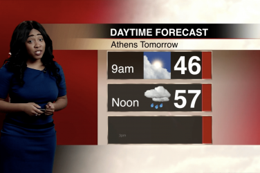
The sun will be out and temperatures will reach the 40s throughout the rest of the afternoon. This will cause some of the snow and ice to melt. Wind gusts between 10 and 15 MPH and up to 25 MPH will continue which may cause additional trees and power lines to go down and power outages to occur.
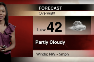
Temperatures will dip below freezing tonight, so water remaining on the streets may form thin layers of black ice. Drivers should be cautious when driving in such conditions.
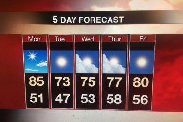
Friday will be mostly sunny with a high of 48 and a 20% chance of rain after 4 PM.